Thank you for visiting our consultation website to find out more about our revised proposals for land at Pinebanks, Langley North, Langley South & Griffin Lane in Thorpe St Andrew.
We have carried out significant community engagement so far. Thank you to everyone who has taken part in our consultation! The valuable feedback we received from the consultation period enabled us to make important changes to the scheme. An addendum submission was made in November 2022 which significantly scaled back the proposed development quantum from 725 to 550. There were also reductions to height, massing and townscape.
We submitted our second round of amendments in May 2024. You can see our updates to the scheme further down the page. Importantly, the reduction in the number of homes remains the same, from 725 to 550 homes.
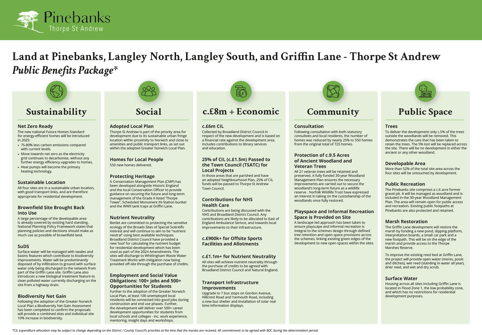
As our development proposals progress, we are now able to provide further clarity on some of the key public benefits that will arise from homes being built.

The key updated documents and summarised content from the May 2024 Amendments are listed below:
- The Planning Statement reflects the final nutrient neutrality strategy (credits), viability conclusions, responses to up-to-date consultation comments and biodiversity net gain (BNG) requirements following the recent adoption of the Greater Norwich Local Plan (GNLP).
- The Financial Viability Assessment (FVA) has been submitted following consultation with the District Council’s viability and cost consultants. The proposed development is now unable to provide any affordable housing principally due to the reduction in housing numbers from 725 to 550 and increased infrastructure and build costs and planning contributions. This position has been agreed by all parties in an independent review.
- Development Parameter Documents have been updated to remove the reference to affordable housing. Updates provide greater clarification on building heights, ground levels and buffer zones to the ancient woodland and veteran trees.
- Following the adoption of the GNLP, a BNG Assessment has been completed to confirm the proposals will provide a combined and individual 10% increase in biodiversity as required from the GNLP.
- Illustrative Layouts for all sites now identify the illustrative locations of Sustainable Drainage Systems (SuDs), the inclusion of allotments and additional landscaping to facilitate BNG.
- Updated Statement of Community Involvement (SCI) to reflect more recent involvement with local stakeholders.
- Flood Risk Assessments (FRA) have been revised in line with statutory consultation comments including the location of Sustainable Drainage Strategies (SuDS) and surface water drainage proposals at Griffin Lane. Revised foul drainage proposals have been provided reflecting the updated nutrient neutrality strategy which involves connection to the public sewer and treatment at Whitlingham Waste Water Treatment Works. Mitigation is to be provided through the purchase of credits from nutrient mitigation schemes. FRAs include updated flood mapping which has not altered the previous conclusions.
- The Landscape and Visual Impact Assessment (LVIA) has been revised in response to comments from the council’s appointed landscape consultant to include additional viewpoints. More certainty was requested around the visual impacts of the development on certain receptors, which has now been now provided. The assessment demonstrates that there are no significant residual landscape or visual effects.
- A Veteran Tree Management Plan has been prepared to form part of the updated LVIA. This plan will ensure the long-term management of these important landscape features.
- Strategic Landscape Masterplans were prepared as part of the LVIA to inform the BNG calculations now required for the Applications. The Masterplans are based on the Development Parameter Plans and the Landscape Mitigation Plans and informs the BNG calculations through highlighting the areas of habitat to be retained, created and enhanced.
- The Ecological Report includes a new ecological walkover survey and provides an updated baseline of the site’s conditions. For example, it includes updates to the bat roost assessments of the buildings and trees as well as incidental sightings of new ecological constraints. The overall impacts and outcomes previously concluded remain true and accurate.
- The updated Conservation Management Plan covering the Thorpe Tower and the Special Duties IN-Station underground wireless communications bunker at Langley North, summaries recent conversations and aspirations to secure a long-term custodian of these assets. It also highlights next steps for the forthcoming Listed Building Application.
The attached video provides an overview of the amendments we proposed in the November 2022 addendum submission that reduced the number of homes from 725 to 550. The addendum submission was in response to the comments, queries and concerns raised by the Council's planning officers, statutory consultees and the local community. Please note that due to the passage of time that the section at the end of the video relating to contributions to Local Community Facilities has been updated by the Public Benefits Package section above.
Video Chapters:
0:00 - Introduction
1:17 - Planning facts
3:14 - Pinebanks
6:55 - Langley North
9:18 - Langley South
15:17 - Griffin Lane
18:34 - Woodland and conservation
22:25 - Contribution to local community facilities.
Watch the video today and find out more about our proposals and how they will benefit your community.
If you would like to be kept up to date with this project and our progress, please register your details with us by clicking the button below.
Background to the Sites
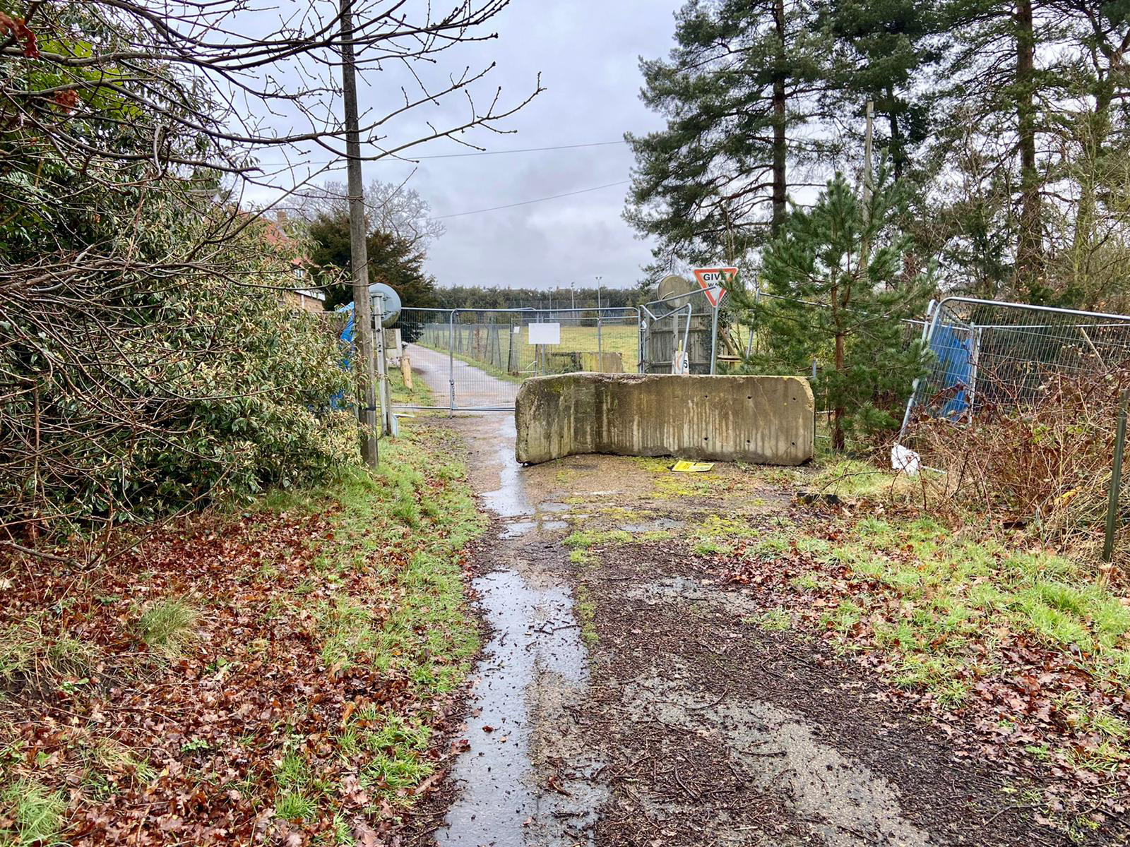
Pinebanks was closed in August 2008 and purchased by Berliet Ltd in December 2009. At that time Berliet Ltd also acquired 46 Hillcrest Road to the north-east corner of the site and since its closure in 2008 the site has remained redundant.
Langley North is the northern part of the former Langley Prep School which vacated the site in July 2016. The site also includes part of what was formerly the Pinebanks site (as defined in the 2013 outline planning approval granted by Broadland District Council), so the Langley North site includes the area previously occupied by the Pinebanks building plus the bowling green and indoor sports courts, and it includes Taylor’s Tower – which is Grade II listed.
Langley South is the southern part of the former Langley Prep site. Since its closure it has largely remained redundant, with some approved use for storage. The current site includes the former school buildings, and the existing access to the former school site, along with a considerable amount of ancient woodland which the current proposals will protect.
Griffin Lane is located in the south-east of Thorpe St Andrew on the Yarmouth Road (A1042) just off the A47 Norwich bypass. The A1042 bounds the site to the northern side and is accessible by pedestrians and cyclists with crossing points over the roundabouts to the business parks and local facilities surrounding the site. There are a series of ‘tank traps’ which are located diagonally through the site, which are a remnant of World War II, and these will be retained as far as possible on the site.
It should be noted that both the Pinebanks and Griffin Lane sites benefit from outline planning permission for residential development. Thorpe St Andrew is part of the priority area for development due to its sustainable urban fringe location within proximity to Norwich and close to amenities and public transport links, as set out within the adopted Greater Norwich Local Plan.
Community Engagement
We consulted widely with the community in May 2021 and submitted our outline planning application to Broadland District Council in November of that year. Since then, we have been working together with the Council’s planning officers to address any comments and queries they have as well as any concerns raised by statutory consultees and the local community. We continued to engage the local community in the following months about the updated proposals which we submitted in November 2022. In May 2024, following extensive engagement with local representatives, including Thorpe St Andrew Town Council, we submitted amendments to the addendum, which you can find outlined above.
We informed the community and stakeholders of our November 2022 submission via our second community newsletter. The newsletter detailed the overall changes, the site-specific amendments and advised how to make comments to the Council. A copy of the newsletter is available in the Downloads section of this website.
If you would like to be kept up to date with this project and our progress, please register your details with us by clicking the button below.
Stakeholder engagement
As part of our ongoing engagement, we recently met on-site with multiple local stakeholders including Cllr. Ian Mackie (Norfolk County Council, Thorpe St Andrew Division). We discussed our plans to deliver a long-term sustainable future for the woodland, ancient woodland and ice age pit which is much-loved by local residents. Following the meeting, Cllr. Mackie commented in the local news:
"Through local campaigning, all four sites have seen reduced housing numbers and the removal of blocks of flats taking the number of houses built down to 550. I'm reassured that the plans proposed now offer a significant step in the right direction overall, including the protection and restoration of the woods, which are both excluded from the area in which development will be delivered. I can see a glint of light at the end of a long tunnel".
All homes will be built to the new national net zero ready standard in sustainable urban locations largely on former brownfield land. More than 52% of the total site area will be untouched by development.
Norfolk Wildlife Trust provided advice on the management of the woodlands and will support on-going measures to care for the area. Senior Manager for Nature Recovery, Helen Baczkowska, commented:
"The woods and chalk pit are fantastic areas for wildlife and people in Thorpe. We know that local people enjoy the bird song and blossom there and support the efforts to help nature thrive in the future".
Stephen Chatfield, Development Director at Ocubis, who are the development managers for the Pinebanks proposals, said:
"Existing heritage assets, ancient woodland and the pit will be handed over to local custodian bodies to ensure their long-term prosperity. Only 5% of trees outside the woodlands will be removed and these will be replaced across the site. The proposals will generate a Biodiversity Net Gain in excess of 10%. In economic terms, the development will generate c.£8m+ of payments for the local area through CIL and s.106 which will contribute towards community facilities and infrastructure. We feel confident that these proposals now strike the right balance for the local community and will bring about much needed homes and investment".
As we have now submitted our May 2024 Amendments to Broadland District Council, we will re-engage with local stakeholders, including Thorpe St Andrew Town Council, Cllr. Mackie and local representatives, about these Amendments to the planning applications.
If you would like to view the planning applications for any of the sites, please click here and enter the reference number below:
Pinebanks: 20212058
Langley North: 20212059
Langley South: 20212060
Griffin Lane: 20212061
If you have any questions or would like to get in touch with the project team, please get in touch via the contact details below.
Downloads
Community Newsletter - November 2022View/Download
Contact
If you have any questions or would like more information or help, please get in touch.
If you would like to be kept up to date with this project and our progress, please register your details with us by clicking the button below.
By Phone
020 3900 3676
By Email
By Post
Pinebanks Engagement Team
44 - 48 Paul St
London
EC2A 4LB


